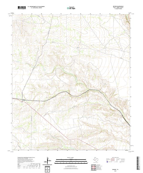
2022 Map of Dryden
USGS Topo · Published 2022About this map
The settlement of Dryden stands as the primary outpost in this corner of Terrell County, defined by its Po and a network of ranch roads that navigate the high desert terrain. The landscape is deeply incised by significant drainage systems, most notably the winding reaches of Thurston Canyon and the northern extent of Meyers Canyon. These geographic features, along with seasonal watercourses like Buck Cr and Magoy Cr, dictate the movement and settlement patterns across this arid region of West Texas.
Find a feature on this map
13 named features on this map. Tap any name to fly to it.
Don’t see what you’re looking for? This feature index may not catch every label — zoom into the map to look around manually.
Map Details
Editions of this 2022 Dryden Map
This is the sole edition of this map. No revisions or reprints were ever made.
Other maps of this area

1918 · Dryden Crossing
USGS Topo · 1:62,500

1928 · Sanderson
USGS Topo · 1:125,000

1943 · Malvado
USGS Topo · 1:62,500

1944 · Malvado
USGS Topo · 1:62,500

1954 · Fort Stockton
USGS Topo · 1:250,000

1954 · Sonora
USGS Topo · 1:250,000

1958 · Sonora
USGS Topo · 1:250,000

1958 · Fort Stockton
USGS Topo · 1:250,000

1958 · Del Rio
USGS Topo · 1:250,000

1959 · Emory Peak
USGS Topo · 1:250,000