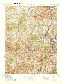
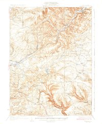
1944 Map of Du Bois
USGS Topo · Published 1944About this map
Coal and timber interests define this mid-century landscape where Jefferson and Clearfield counties meet. The industrial heart of the region is centered on the railway junctions at DuBois and Falls Creek, where lines of the Pennsylvania RR, Baltimore and Ohio RR, and Pittsburgh and Shawmut RR converge to move resources from the interior. Evidence of the mining economy is visible at Eleanora Mines and the surrounding worker settlements like Coal Glen and Pardus.
Find a feature on this map
104 named features on this map. Tap any name to fly to it.
Don’t see what you’re looking for? This feature index may not catch every label — zoom into the map to look around manually.
Map Details
Editions of this 1944 Du Bois Map
This is the sole edition of this map. No revisions or reprints were ever made.
Other maps of this area
1903 · Curwensville
USGS Topo · 1:62,500
1906 · Punxsutawney
USGS Topo · 1:62,500
1909 · Smicksburg
USGS Topo · 1:62,500
1918 · Loleta
USGS Topo · 1:62,500

1922 · Du Bois
USGS Topo · 1:62,500

1924 · Du Bois
USGS Topo · 1:62,500
1924 · Brookville
USGS Topo · 1:62,500
1926 · Brookville
USGS Topo · 1:62,500
1929 · Penfield
USGS Topo · 1:62,500
1932 · Penfield
USGS Topo · 1:62,500