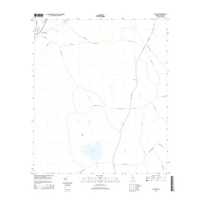
2014 Map of Du Pont
USGS Topo · Published 2014About this map
Du Pont serves as the primary focal point of this Clinch County landscape, where the local street grid including Main St and Railroad St meets the rural road network. The surrounding terrain is defined by a network of slow-moving water bodies and wetlands typical of south Georgia, including Sweetwater Cr, Jones Cr, and the broad expanse of Lees Bay. Family and community history is preserved at the Dame Cem near Lake Verne and the Eason Cem further east, reflecting the long-standing agricultural and timber-related settlement patterns of the region. Transportation routes like the Thelma Hwy and Ga-187 connect these scattered rural landmarks, while specialized naming such as Hunting Club Rd and Cutting Rd suggests the continued importance of land use for recreation and industry in this corner of the state.
Find a feature on this map
33 named features on this map. Tap any name to fly to it.
Don’t see what you’re looking for? This feature index may not catch every label — zoom into the map to look around manually.
Map Details
Editions of this 2014 Du Pont Map
This is the sole edition of this map. No revisions or reprints were ever made.
Other maps of this area

1953 · Waycross
USGS Topo · 1:250,000

1954 · Valdosta
USGS Topo · 1:250,000

1958 · Valdosta
USGS Topo · 1:250,000

1958 · Waycross
USGS Topo · 1:250,000

1959 · Valdosta
USGS Topo · 1:250,000

1968 · Homerville East
USGS Topo · 1:24,000

1968 · Midway
USGS Topo · 1:24,000

1968 · Headlight
USGS Topo · 1:24,000

1971 · Thelma
USGS Topo · 1:24,000

1971 · Du Pont
USGS Topo · 1:24,000