
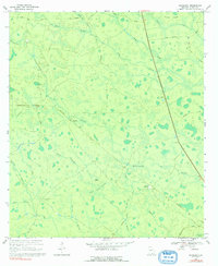
1968 Map of Headlight
USGS Topo · Published 1970About this map
The Southern railroad line cuts a direct path through the heart of this Clinch County landscape, connecting the small settlement of Headlight to the surrounding swampy terrain of South Georgia. Surveyed in the late 1960s, the area is defined by a complex network of shallow wetlands and bays, including McGarrity Bay, Walters Bay, and Statvey Bay. These depressions create a mosaic of dry land and standing water, where timber and transit likely shaped the local economy.
Find a feature on this map
30 named features on this map. Tap any name to fly to it.
Don’t see what you’re looking for? This feature index may not catch every label — zoom into the map to look around manually.
Map Details
Editions of this 1968 Headlight Map
2 editions found
Other maps of this area

1954 · Valdosta
USGS Topo · 1:250,000

1958 · Valdosta
USGS Topo · 1:250,000

1959 · Valdosta
USGS Topo · 1:250,000

1967 · Spooner
USGS Topo · 1:24,000

1967 · Colon
USGS Topo · 1:24,000

1967 · Fargo
USGS Topo · 1:24,000

1968 · Midway
USGS Topo · 1:24,000

1968 · Needmore
USGS Topo · 1:24,000

1971 · Thelma
USGS Topo · 1:24,000

1971 · Du Pont
USGS Topo · 1:24,000