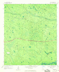
1968 Map of Needmore
USGS Topo · Published 1970About this map
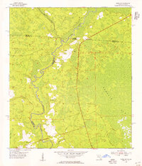
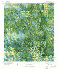
The settlement of Needmore sits at the heart of this landscape, positioned along Route 94 where the road bisects the wetlands of southern Georgia. This late 1960s environment is defined by an intricate network of water and swamp, from the broad Cowhouse Bay to the winding Suwannee River that traces the southern border. The map documents a rural economy rooted in the swampy interior, evidenced by named locations like Pierce Camp, Weatherington Camp, and the riverside Log Landing.
Find a feature on this map
48 named features on this map. Tap any name to fly to it.
Don’t see what you’re looking for? This feature index may not catch every label — zoom into the map to look around manually.
Map Details
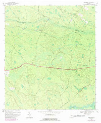
Editions of this 1968 Needmore Map
2 editions found
Other maps of this area

1954 · Valdosta
USGS Topo · 1:250,000
1955 · Council
USGS Topo · 1:24,000
1955 · Cypress Creek
USGS Topo · 1:24,000
1955 · Fargo SW
USGS Topo · 1:24,000

1958 · Valdosta
USGS Topo · 1:250,000

1959 · Valdosta
USGS Topo · 1:250,000
1967 · Colon
USGS Topo · 1:24,000
1967 · Fargo
USGS Topo · 1:24,000
1968 · Headlight
USGS Topo · 1:24,000
1971 · Thelma
USGS Topo · 1:24,000