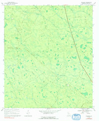
1968 Map of Headlight
USGS Topo · Published 1992About this map
Southern railroad tracks cut a sharp diagonal through this remote portion of Clinch County, connecting the small settlements of Headlight and Ernest. The landscape is dominated by an intricate network of wetlands and seasonal drainages, including the expansive Cart Island Swamp and several namesake "bays" like McGarrity Bay, Walters Bay, and Stotwell Bay. These features, alongside Sawgrass Pond, reveal the hydrological character of the Georgia flatwoods before modern drainage alterations significantly changed the region's face.
Find a feature on this map
33 named features on this map. Tap any name to fly to it.
Don’t see what you’re looking for? This feature index may not catch every label — zoom into the map to look around manually.
Map Details
Editions of this 1968 Headlight Map
2 editions found
Other maps of this area

1954 · Valdosta
USGS Topo · 1:250,000

1958 · Valdosta
USGS Topo · 1:250,000

1959 · Valdosta
USGS Topo · 1:250,000

1967 · Spooner
USGS Topo · 1:24,000

1967 · Colon
USGS Topo · 1:24,000

1967 · Fargo
USGS Topo · 1:24,000

1968 · Midway
USGS Topo · 1:24,000

1968 · Needmore
USGS Topo · 1:24,000

1968 · Headlight
USGS Topo · 1:24,000

1971 · Thelma
USGS Topo · 1:24,000