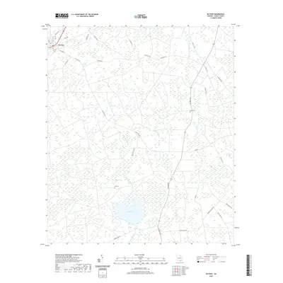
2020 Map of Du Pont
USGS Topo · Published 2020About this map
Du Pont serves as the primary settlement on this sheet, tucked into the northwestern corner near the junction of several local roads like Lightsey St and Woodward. The landscape is defined by the unique hydrology of Clinch County, where numerous shallow basins known as bays—including Whitehead Bay, Green Bay, and Schoolhouse Bay—dot the terrain. These wetlands are interspersed with slow-moving watercourses such as Sweetwater Cr and Jones Creek. Lake Verne provides a significant open water feature in the southern portion of the map, surrounded by a network of rural routes. Genealogists will find interest in the documented locations of Dame Cem and Eason Cem, which are positioned near early family-named corridors like Edward Lee Rd and Williams Rd, reflecting the deep-rooted agricultural and timber heritage of this South Georgia region.
Find a feature on this map
40 named features on this map. Tap any name to fly to it.
Don’t see what you’re looking for? This feature index may not catch every label — zoom into the map to look around manually.
Map Details
Editions of this 2020 Du Pont Map
This is the sole edition of this map. No revisions or reprints were ever made.
Other maps of this area

1953 · Waycross
USGS Topo · 1:250,000

1954 · Valdosta
USGS Topo · 1:250,000

1958 · Valdosta
USGS Topo · 1:250,000

1958 · Waycross
USGS Topo · 1:250,000

1959 · Valdosta
USGS Topo · 1:250,000

1968 · Homerville East
USGS Topo · 1:24,000

1968 · Midway
USGS Topo · 1:24,000

1968 · Headlight
USGS Topo · 1:24,000

1971 · Thelma
USGS Topo · 1:24,000

1971 · Du Pont
USGS Topo · 1:24,000