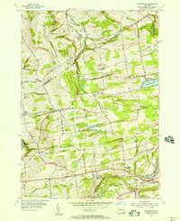
1954 Map of Duanesburg
USGS Topo · Published 1956About this map
Mariaville Lake and the village of Mariaville anchor the eastern landscape of this mid-1950s survey, illustrating a region defined by its colonial-era legacy and rural infrastructure. The boundary between Montgomery Co and Schenectady Co cuts through a terrain marked by numerous small crossroads settlements like Braman Corners and Scotch Bush. The map provides significant genealogical value through its density of small burial grounds, including the Scotch Bush Cem, Eaton Corners Cem, and Ryderdell Cem.
Find a feature on this map
53 named features on this map. Tap any name to fly to it.
Don’t see what you’re looking for? This feature index may not catch every label — zoom into the map to look around manually.
Map Details
Editions of this 1954 Duanesburg Map
3 editions found
Other maps of this area

1895 · Amsterdam
USGS Topo · 1:62,500

1896 · Fonda
USGS Topo · 1:62,500

1898 · Fonda
USGS Topo · 1:62,500

1898 · Schoharie
USGS Topo · 1:62,500

1900 · Schoharie
USGS Topo · 1:62,500

1900 · Schoharie
USGS Topo · 1:31,680

1900 · Berne
USGS Topo · 1:62,500

1902 · Fonda
USGS Topo · 1:62,500

1903 · Berne
USGS Topo · 1:62,500

1931 · Amsterdam
USGS Topo · 1:62,500