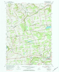
1954 Map of Duanesburg
USGS Topo · Published 1984About this map
Florida and Duanesburg townships meet along the ridge of McKinney Hill, where a dense network of country roads connects family-named cemeteries and rural crossroads. The mid-century landscape is defined by its water management and early aviation, featuring the Duanesburg Res and Delanson Reservoir, alongside Sky Haven Airport south of the Delaware And Hudson rail lines. This 1954 field-checked survey reveals a territory transitioning from its deep agricultural roots to a modern infrastructure, while maintaining historic community centers like Scotch Bush and Braman Corners. Genealogists will find significant value in the numerous precisely located burial grounds, such as the Feydendall Cem and Stewart Cem, which anchor the map's historical geography. The settlement at Mariaville overlooks Mariaville Lake, while the village of Delanson serves as a local hub near the southern border.
Find a feature on this map
60 named features on this map. Tap any name to fly to it.
Don’t see what you’re looking for? This feature index may not catch every label — zoom into the map to look around manually.
Map Details
Editions of this 1954 Duanesburg Map
3 editions found
Other maps of this area

1895 · Amsterdam
USGS Topo · 1:62,500

1896 · Fonda
USGS Topo · 1:62,500

1898 · Fonda
USGS Topo · 1:62,500

1898 · Schoharie
USGS Topo · 1:62,500

1900 · Schoharie
USGS Topo · 1:62,500

1900 · Schoharie
USGS Topo · 1:31,680

1900 · Berne
USGS Topo · 1:62,500

1902 · Fonda
USGS Topo · 1:62,500

1903 · Berne
USGS Topo · 1:62,500

1931 · Amsterdam
USGS Topo · 1:62,500