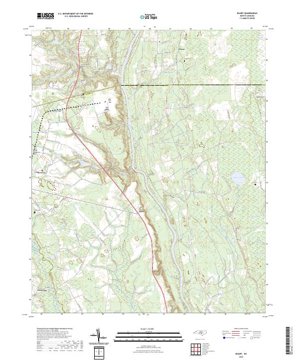
2022 Map of Duart
USGS Topo · Published 2022About this map
The Cape Fear River carves a central path through this section of the coastal plain, marking the border between the upland pine woods and the intricate wetland systems of Bladen and Cumberland counties. The landscape is defined by its numerous "bays"—elliptical depressions unique to the region—such as Burrell Bay, Little Gallberry Bay, and Brisson Bay. These features, alongside the expansive Little Alligator Swamp, suggest a terrain shaped by ancient hydrological patterns that dictate the placement of modern roads and small communities like Duart and Tobermory.
Find a feature on this map
83 named features on this map. Tap any name to fly to it.
Don’t see what you’re looking for? This feature index may not catch every label — zoom into the map to look around manually.
Map Details
Editions of this 2022 Duart Map
This is the sole edition of this map. No revisions or reprints were ever made.
Other maps of this area

1953 · Florence
USGS Topo · 1:250,000

1954 · Florence
USGS Topo · 1:250,000

1955 · Elizabethtown
USGS Topo · 1:62,500

1957 · Bladenboro
USGS Topo · 1:62,500

1959 · Roseboro
USGS Topo · 1:62,500

1959 · Saint Pauls
USGS Topo · 1:62,500

1982 · Elizabethtown
USGS Topo · 1:100,000

1986 · Tar Heel
USGS Topo · 1:24,000
1986 · Hope Mills
USGS Topo · 1:24,000
1986 · Northeast Lumberton
USGS Topo · 1:24,000