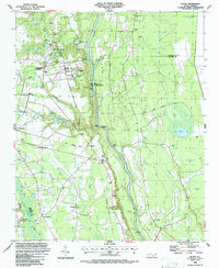
1986 Map of Duart
USGS Topo · Published 1987About this map
The Cape Fear River dominates this mid-1980s landscape, serving as a central artery for industrial and recreational activity. Significant infrastructure such as the William O Huske Lock and Dam No 3, Prospect Hall Landing, and several Gaging Sta installations reflect the managed water system of the era. To the west, the presence of Sewage Disposal and Ind Waste Ponds indicates established utility footprints near the community of Tobermory.
Find a feature on this map
48 named features on this map. Tap any name to fly to it.
Don’t see what you’re looking for? This feature index may not catch every label — zoom into the map to look around manually.
Map Details
Editions of this 1986 Duart Map
This is the sole edition of this map. No revisions or reprints were ever made.
Other maps of this area

1953 · Florence
USGS Topo · 1:250,000

1954 · Florence
USGS Topo · 1:250,000

1955 · Elizabethtown
USGS Topo · 1:62,500

1957 · Bladenboro
USGS Topo · 1:62,500

1959 · Roseboro
USGS Topo · 1:62,500

1959 · Saint Pauls
USGS Topo · 1:62,500

1982 · Elizabethtown
USGS Topo · 1:100,000

1986 · Tar Heel
USGS Topo · 1:24,000
1986 · Hope Mills
USGS Topo · 1:24,000
1986 · Northeast Lumberton
USGS Topo · 1:24,000