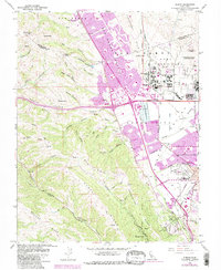
1961 Map of Dublin
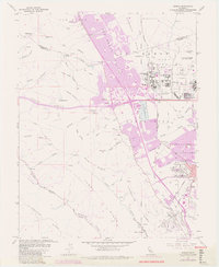
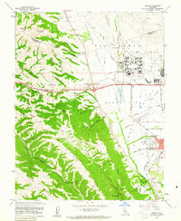
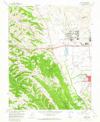
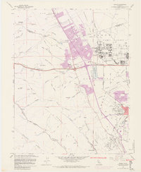
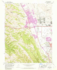
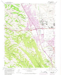
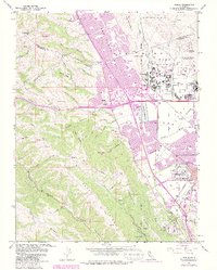
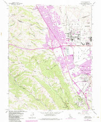
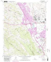
USGS Topo · Published 1981About this map
San Ramon (Norris) and the adjacent San Ramon Village sit within a rapidly urbanizing corridor of Alameda County in this early 1960s survey, revised in 1980. The map captures a transition as suburban developments like Komandorski Village expand near established hubs like Dublin and Pleasanton. The presence of Camp Parks, a large Military Reservation, and the Federal Youth Center underscores the significant government and institutional footprint in the valley during this era.
Find a feature on this map
74 named features on this map. Tap any name to fly to it.
Don’t see what you’re looking for? This feature index may not catch every label — zoom into the map to look around manually.
Map Details
Editions of this 1961 Dublin Map
10 editions found
Other maps of this area

1896 · Mt. Diablo
USGS Topo · 1:62,500

1897 · Concord
USGS Topo · 1:62,500

1898 · Mt. Diablo
USGS Topo · 1:62,500

1899 · Haywards
USGS Topo · 1:62,500

1906 · Pleasanton
USGS Topo · 1:62,500

1915 · Haywards
USGS Topo · 1:62,500

1915 · Concord
USGS Topo · 1:62,500

1941 · Pleasanton
USGS Topo · 1:62,500

1942 · Concord
USGS Topo · 1:62,500

1942 · Hayward
USGS Topo · 1:62,500