2022 Map of Dublin
USGS Topo · Published 2022About this map
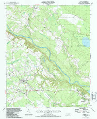
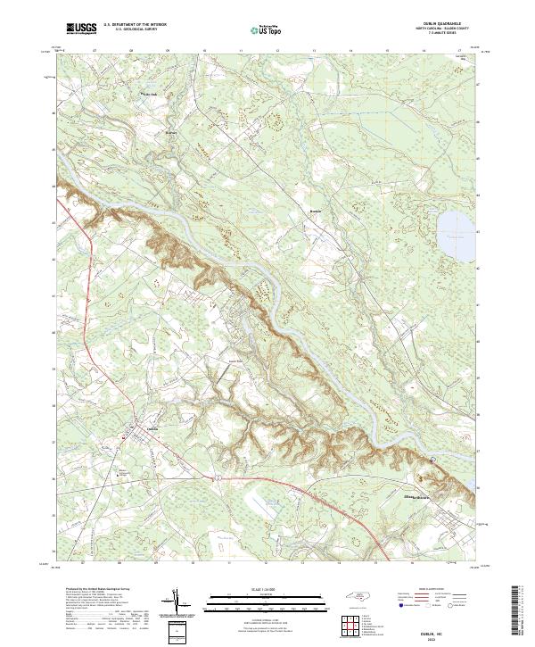
The Cape Fear River winds through the heart of Bladen County in this 2022 survey, shaping a landscape defined by its distinctive Carolina bays and wetland basins. These geologically significant depressions, including Salters Lake, McNeil Bay, and Sheriff White Bay, punctuate the sandy terrain surrounding the settlements of Dublin and White Oak. The map reveals a rural transition where traditional land use meets modern education and infrastructure, notably at the Bladen Community College campus located just south of the Dublin town center.
Find a feature on this map
99 named features on this map. Tap any name to fly to it.
Don’t see what you’re looking for? This feature index may not catch every label — zoom into the map to look around manually.
Map Details
Editions of this 2022 Dublin Map
This is the sole edition of this map. No revisions or reprints were ever made.