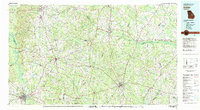
1981 Map of Dublin
USGS Topo · Published 1981About this map
Sandersville and Tennille anchor the northwestern reaches of this East Georgia landscape, where the agricultural heartland is defined by the winding paths of the Oconee River and the Ogeechee River. The 1981 data highlights a region deeply connected by rail and water, with the Central of Georgia and Seaboard Coast Line railroads threading through industrial hubs like Wadley, Louisville, and Midville.
Find a feature on this map
72 named features on this map. Tap any name to fly to it.
Don’t see what you’re looking for? This feature index may not catch every label — zoom into the map to look around manually.
Map Details
Editions of this 1981 Dublin Map
This is the sole edition of this map. No revisions or reprints were ever made.
Other maps of this area

1912 · Milledgeville
USGS Topo · 1:62,500

1916 · Irwinton
USGS Topo · 1:62,500

1919 · Gough
USGS Topo · 1:62,500

1920 · Statesboro
USGS Topo · 1:62,500

1920 · Stapleton
USGS Topo · 1:62,500

1920 · Millen
USGS Topo · 1:62,500

1920 · Greens Cut
USGS Topo · 1:62,500

1920 · Irwinton
USGS Topo · 1:62,500

1921 · Rocky Ford
USGS Topo · 1:62,500

1943 · Greens Cut
USGS Topo · 1:62,500