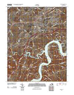
2010 Map of Dublin
USGS Topo · Published 2010About this map
Claytor Lake and the wide bends of the New River dominate the southern portion of this landscape, defining the character of Pulaski County as it appeared in 2010. The northeastern corner is marked by the sprawling industrial infrastructure of the Radford Army Ammunition Plant, a significant federal facility contrasted by the residential clusters of Dublin and Highland Park. Genealogists will find a wealth of burial sites across the terrain, from Highland Memory Gardens near the ammunition plant to smaller family or community plots like Hurst Cemetery and Rhoades Cemetery. The settlement of Newbern sits central to the sheet, with historic transport routes like Lee Hwy and Old Route 11 weaving through the upland. To the southwest, the terrain rises toward Draper Mountain and Peak Knob, where the rugged topography overlooking Pulaski shapes the local drainage of Peak Creek and its many branches.
Find a feature on this map
98 named features on this map. Tap any name to fly to it.
Don’t see what you’re looking for? This feature index may not catch every label — zoom into the map to look around manually.
Map Details
Editions of this 2010 Dublin Map
This is the sole edition of this map. No revisions or reprints were ever made.
Other maps of this area

1889 · Hillsville
USGS Topo · 1:125,000

1890 · Dublin
USGS Topo · 1:125,000

1891 · Dublin
USGS Topo · 1:125,000

1892 · Hillsville
USGS Topo · 1:125,000

1896 · Hillsville
USGS Topo · 1:125,000

1930 · Max Meadows
USGS Topo · 1:62,500

1934 · Pulaski
USGS Topo · 1:48,000

1940 · Pulaski
USGS Topo · 1:62,500

1950 · Radford
USGS Topo · 1:62,500

1953 · Winston-Salem
USGS Topo · 1:250,000