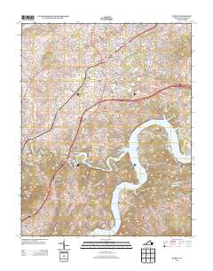
2013 Map of Dublin
USGS Topo · Published 2013About this map
The town of Dublin serves as a central hub in this Pulaski County landscape, where the long-established transportation corridors of the Lee Hwy and Dora Hwy intersect. The terrain is defined by the winding course of the New River, which widens into the expansive Claytor Lake to the south. This area illustrates the transition from industrial clusters like Burlington Mills to the more dispersed rural settlements of Newbern and Shiloh. To the southwest, the elevation rises sharply at Draper Mountain Peak Knob, overlooking the small community of Draper and the winding paths of Peak Cr and Thorne Springs Br. Local history is embedded in the network of family-named roads and small hollows, such as Oppossum Hollow and McAdam, which reflect the region's agricultural and industrial roots along the river valley.
Find a feature on this map
208 named features on this map. Tap any name to fly to it.
Don’t see what you’re looking for? This feature index may not catch every label — zoom into the map to look around manually.
Map Details
Editions of this 2013 Dublin Map
This is the sole edition of this map. No revisions or reprints were ever made.
Other maps of this area

1889 · Hillsville
USGS Topo · 1:125,000

1890 · Dublin
USGS Topo · 1:125,000

1891 · Dublin
USGS Topo · 1:125,000

1892 · Hillsville
USGS Topo · 1:125,000

1896 · Hillsville
USGS Topo · 1:125,000

1930 · Max Meadows
USGS Topo · 1:62,500

1934 · Pulaski
USGS Topo · 1:48,000

1940 · Pulaski
USGS Topo · 1:62,500

1950 · Radford
USGS Topo · 1:62,500

1953 · Winston-Salem
USGS Topo · 1:250,000