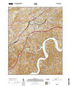
2019 Map of Dublin
USGS Topo · Published 2019About this map
Dublin and the surrounding Pulaski County landscape are defined by a mix of educational institutions, industrial pockets, and memorial sites. The presence of New River Community College and Burlington Mills indicates a local economy built on modern manufacturing and vocational training. To the south, the waters of Claytor Lake reach into the terrain, creating a distinctive shoreline near McAdam and Shiloh.
Find a feature on this map
166 named features on this map. Tap any name to fly to it.
Don’t see what you’re looking for? This feature index may not catch every label — zoom into the map to look around manually.
Map Details
Editions of this 2019 Dublin Map
This is the sole edition of this map. No revisions or reprints were ever made.
Other maps of this area

1889 · Hillsville
USGS Topo · 1:125,000

1890 · Dublin
USGS Topo · 1:125,000

1891 · Dublin
USGS Topo · 1:125,000

1892 · Hillsville
USGS Topo · 1:125,000

1896 · Hillsville
USGS Topo · 1:125,000

1930 · Max Meadows
USGS Topo · 1:62,500

1934 · Pulaski
USGS Topo · 1:48,000

1940 · Pulaski
USGS Topo · 1:62,500

1950 · Radford
USGS Topo · 1:62,500

1953 · Winston-Salem
USGS Topo · 1:250,000