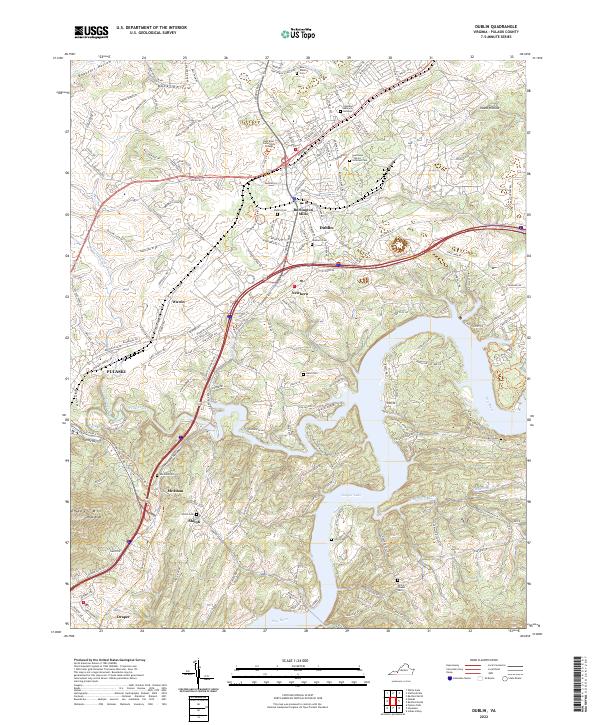
2022 Map of Dublin
USGS Topo · Published 2022About this map
Claytor Lake dominates the southern landscape of this Virginia quadrangle, where the New River is impounded amidst a series of sharp ridges and deep hollows. The settlement of Dublin serves as a central hub, supported by the New River Community College and a corridor of industry including Burlington Mills. This modern survey reveals a dense network of local history and commemorative sites, from the sprawling Southwest Virginia Veterans Cemetery to numerous smaller family and church grounds like Cecil Cem and Hurst Cem. The Norfolk Southern railroad tracks wind through the terrain, passing the small communities of McAdam and Draper as they parallel the base of Draper Mountain. Between the industrial growth near Pulaski and the recreation areas along the lake, the map preserves the enduring character of these mountain settlements and their historic sites like the New Dublin Church.
Find a feature on this map
39 named features on this map. Tap any name to fly to it.
Don’t see what you’re looking for? This feature index may not catch every label — zoom into the map to look around manually.
Map Details
Editions of this 2022 Dublin Map
This is the sole edition of this map. No revisions or reprints were ever made.
Historical Maps of Newbern Through Time
4 maps found