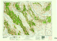
1958 Map of Dubois
USGS Topo · Published 1958About this map
Borah Peak and the high summits of the Lost River Range dominate this 1958 survey of the high desert and mountain frontier where Idaho meets Montana. The landscape is defined by the Continental Divide, which snakes through the Beaverhead Mountains and across Monida Pass, a critical corridor for the Union Pacific railroad and U.S. 91. Resource extraction and agricultural research are evident in the scatter of high-altitude operations, including the Elmira Mine and the Sheep experimental station near Dubois. Along the southern valley floor, irrigation and drainage patterns emerge around Mud Lake and the Little Lost River. This era shows a transition in transit, with several stretches labeled as Dismantled railroad appearing alongside the primary highway network of U.S. 93 and its alternate routes serving the ranching communities of Camas and Small.
Find a feature on this map
108 named features on this map. Tap any name to fly to it.
Don’t see what you’re looking for? This feature index may not catch every label — zoom into the map to look around manually.
Map Details
Editions of this 1958 Dubois Map
2 editions found

Other maps of this area

1888 · Three Forks
USGS Topo · 1:250,000

1893 · Dillon
USGS Topo · 1:250,000

1894 · Three Forks
USGS Topo · 1:250,000

1895 · Three Forks
USGS Topo · 1:250,000

1895 · Hailey
USGS Topo · 1:125,000

1897 · Hailey
USGS Topo · 1:125,000

1929 · Bayhorse
USGS Topo · 1:125,000

1935 · MacKay
USGS Topo · 1:96,000

1935 · Borah Peak
USGS Topo · 1:125,000

1938 · Borah Peak
USGS Topo · 1:125,000