
1958 Map of Dubois
USGS Topo · Published 1958About this map
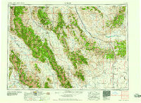
The Continental Divide zigzags across this high-altitude landscape, defining the rugged border between Idaho and Montana in the late 1950s. Mining activity is prominent throughout the Lemhi Range, with operations such as the Copper Queen Mine, Maryland Mine, and Tinkers Mine clustered near Leadore. The region is a patchwork of federal lands, including the Salmon National Forest, Challis National Forest, and Targhee National Forest, showcasing a complex system of resource management through various ranger stations like Mahogany and Bell Mountain.
Find a feature on this map
143 named features on this map. Tap any name to fly to it.
Don’t see what you’re looking for? This feature index may not catch every label — zoom into the map to look around manually.
Map Details
Editions of this 1958 Dubois Map
2 editions found
Other maps of this area

1888 · Three Forks
USGS Topo · 1:250,000

1893 · Dillon
USGS Topo · 1:250,000

1894 · Three Forks
USGS Topo · 1:250,000

1895 · Three Forks
USGS Topo · 1:250,000

1895 · Hailey
USGS Topo · 1:125,000

1897 · Hailey
USGS Topo · 1:125,000

1929 · Bayhorse
USGS Topo · 1:125,000

1935 · MacKay
USGS Topo · 1:96,000

1935 · Borah Peak
USGS Topo · 1:125,000

1938 · Borah Peak
USGS Topo · 1:125,000