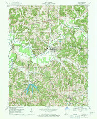
1969 Map of Dubois
USGS Topo · Published 1970About this map
Dubois and the surrounding townships of Harbison and Marion characterize this region of southern Indiana as it appeared in the late 1960s. The landscape is defined by the winding course of the Patoka River and the newly established Beaver Creek Reservoir. This era shows a community deeply rooted in its local institutions, evidenced by the cluster of religious and educational sites such as St Peters Ch, St Raphaels Ch, and the St Celestine Sch.
Find a feature on this map
39 named features on this map. Tap any name to fly to it.
Don’t see what you’re looking for? This feature index may not catch every label — zoom into the map to look around manually.
Map Details
Editions of this 1969 Dubois Map
3 editions found
Other maps of this area

1946 · Jasper
USGS Topo · 1:24,000

1951 · Hillham
USGS Topo · 1:24,000

1954 · Dubois
USGS Topo · 1:24,000

1954 · Huntingburg
USGS Topo · 1:24,000

1955 · Saint Anthony
USGS Topo · 1:24,000

1956 · Alfordsville
USGS Topo · 1:24,000

1956 · Rusk
USGS Topo · 1:24,000

1956 · Vincennes
USGS Topo · 1:250,000

1957 · Vincennes
USGS Topo · 1:250,000

1957 · Cuzco
USGS Topo · 1:24,000