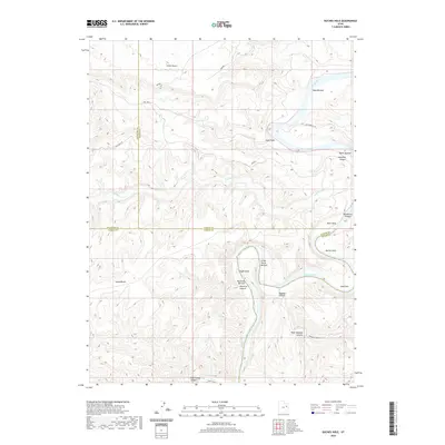
2020 Map of Duches Hole
USGS Topo · Published 2020About this map
The Green River carves a deep, winding path through this corner of the Uintah Basin, defining a landscape of isolated river bottoms and high plateaus. This remote territory at the meeting of Uintah, Duchesne, and Carbon counties is characterized by the river's serpentine bends, which create distinct named flats such as Boat Bottom, Maverick Bottom, and Ranch Bottom. These rare stretches of level ground along the water contrast sharply with the surrounding verticality of Desolation Canyon and Ninemile Canyon.
Find a feature on this map
27 named features on this map. Tap any name to fly to it.
Don’t see what you’re looking for? This feature index may not catch every label — zoom into the map to look around manually.
Map Details
Editions of this 2020 Duches Hole Map
This is the sole edition of this map. No revisions or reprints were ever made.
Other maps of this area

1885 · East Tavaputs
USGS Topo · 1:250,000

1886 · Price River
USGS Topo · 1:250,000

1896 · Price River
USGS Topo · 1:250,000

1953 · Nutters Hole
USGS Topo · 1:62,500

1953 · Firewater Canyon
USGS Topo · 1:62,500

1954 · Flat Canyon
USGS Topo · 1:62,500

1956 · Price
USGS Topo · 1:250,000

1956 · Grand Junction
USGS Topo · 1:250,000

1959 · Grand Junction
USGS Topo · 1:250,000

1960 · Price
USGS Topo · 1:250,000