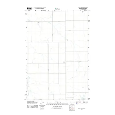
2011 Map of Duck Creek
USGS Topo · Published 2011About this map
The extractive industry and livestock economy of the high plains intersect in this survey of the North Dakota-Montana borderlands. Local industrial history is marked by the presence of the Black Diamond Mine and Golden Glow Coal Mine, signaling the region's relationship with coal. The landscape is defined by the drainage of Duck Creek and Lamesteer Creek, which cross a grid of section roads like State Line Rd and Carlyle Rd. Aviation and water management are represented by the Hollstein Ranch Airport and the Johnstone Dam to the southeast. The survey provides a clear view of how rural infrastructure evolved to support isolated ranches and mining operations at the start of the 21st century.
Find a feature on this map
22 named features on this map. Tap any name to fly to it.
Don’t see what you’re looking for? This feature index may not catch every label — zoom into the map to look around manually.
Map Details
Editions of this 2011 Duck Creek Map
This is the sole edition of this map. No revisions or reprints were ever made.
Other maps of this area

1953 · Miles City
USGS Topo · 1:250,000

1953 · Dickinson
USGS Topo · 1:250,000

1957 · Dickinson
USGS Topo · 1:250,000

1957 · Miles City
USGS Topo · 1:250,000

1958 · Miles City
USGS Topo · 1:250,000

1980 · Golva
USGS Topo · 1:24,000
1980 · Beach East
USGS Topo · 1:24,000

1980 · Thelan
USGS Topo · 1:24,000

1980 · Belfield
USGS Topo · 1:100,000

1981 · Carlyle
USGS Topo · 1:24,000