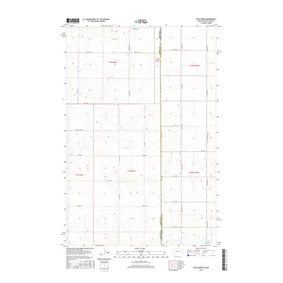
2017 Map of Duck Creek
USGS Topo · Published 2017About this map
The high plains landscape along the Montana-North Dakota state line is defined by the winding course of Duck Cr and the rural road networks that link scattered homesteads and ranches. This 2017 survey documents a transition zone where the Wibaux and Golden Valley county boundaries meet, anchored by the waters of Johnstone Dam in the southeast. The map reveals a strictly organized section line system, with corridors like Carlyle Rd and Thelen Rd providing the primary transit through the rolling terrain. Smaller drainage features such as Lamesteer Cr provide critical water sources in an otherwise arid environment, while local routes like Last Chance Trl and St Philip Rd hint at the personal histories and naming conventions of the families who settled this borderland region.
Find a feature on this map
28 named features on this map. Tap any name to fly to it.
Don’t see what you’re looking for? This feature index may not catch every label — zoom into the map to look around manually.
Map Details
Editions of this 2017 Duck Creek Map
This is the sole edition of this map. No revisions or reprints were ever made.
Other maps of this area

1953 · Miles City
USGS Topo · 1:250,000

1953 · Dickinson
USGS Topo · 1:250,000

1957 · Dickinson
USGS Topo · 1:250,000

1957 · Miles City
USGS Topo · 1:250,000

1958 · Miles City
USGS Topo · 1:250,000

1980 · Golva
USGS Topo · 1:24,000
1980 · Beach East
USGS Topo · 1:24,000

1980 · Thelan
USGS Topo · 1:24,000

1980 · Belfield
USGS Topo · 1:100,000

1981 · Carlyle
USGS Topo · 1:24,000