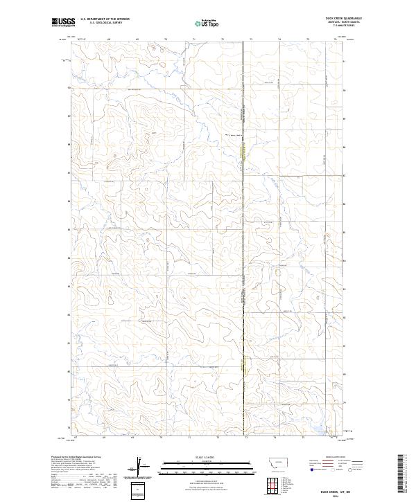
2024 Map of Duck Creek
USGS Topo · Published 2024About this map
The Montana North Dakota state line bisects this high-plains landscape, where the headwaters of Duck Creek and Lone Tree Creek define the drainage patterns of the borderlands. This region, shared by Wibaux Co and Golden Valley Co, is characterized by a sparse but deliberate network of section-line roads and named tracks that suggest a long history of ranching and dryland farming. Local family names and descriptors are preserved in thoroughfares such as Quade Ln, Griffith Dr, and Red Top East Rd, while Last Chance Trl hints at the isolation inherent in this corner of the West. The survey illustrates the transition from the rectangular survey system of the Dakotas into the varied terrain of eastern Montana, showing how modern land use continues to follow the early 20th-century township and range divisions.
Find a feature on this map
28 named features on this map. Tap any name to fly to it.
Don’t see what you’re looking for? This feature index may not catch every label — zoom into the map to look around manually.
Map Details
Editions of this 2024 Duck Creek Map
This is the sole edition of this map. No revisions or reprints were ever made.
Other maps of this area

1953 · Miles City
USGS Topo · 1:250,000

1953 · Dickinson
USGS Topo · 1:250,000

1957 · Dickinson
USGS Topo · 1:250,000

1957 · Miles City
USGS Topo · 1:250,000

1958 · Miles City
USGS Topo · 1:250,000

1980 · Golva
USGS Topo · 1:24,000
1980 · Beach East
USGS Topo · 1:24,000

1980 · Thelan
USGS Topo · 1:24,000

1980 · Belfield
USGS Topo · 1:100,000

1981 · Carlyle
USGS Topo · 1:24,000