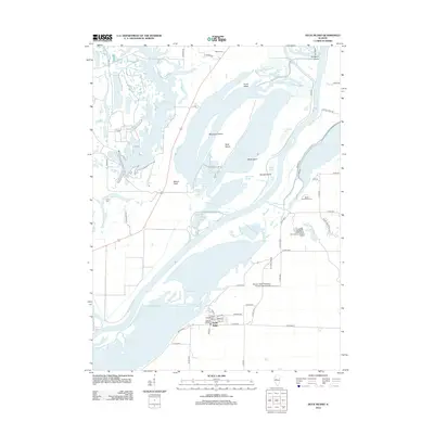
2012 Map of Duck Island
USGS Topo · Published 2012About this map
Goofy Ridge sits at the southern end of a complex aquatic landscape where the Illinois River creates a wide network of side channels and wetlands. The area is defined by a series of significant water bodies including Rice Lake, Mud Lake, and Clear Lake, interspersed with large islands such as Duck Island, Miserable Island, and Mink Island. This topography reflects the intensive management of the river bottomlands for both industrial and conservation purposes during the early twenty-first century.
Find a feature on this map
73 named features on this map. Tap any name to fly to it.
Don’t see what you’re looking for? This feature index may not catch every label — zoom into the map to look around manually.
Map Details
Editions of this 2012 Duck Island Map
This is the sole edition of this map. No revisions or reprints were ever made.
Other maps of this area

1912 · Canton
USGS Topo · 1:62,500

1925 · Havana
USGS Topo · 1:62,500

1929 · Manito
USGS Topo · 1:62,500

1930 · Glasford
USGS Topo · 1:62,500

1932 · Manito
USGS Topo · 1:62,500

1947 · St. David
USGS Topo · 1:24,000

1947 · Havana
USGS Topo · 1:24,000

1948 · St. David
USGS Topo · 1:24,000
1948 · Havana
USGS Topo · 1:24,000

1948 · Glasford
USGS Topo · 1:62,500