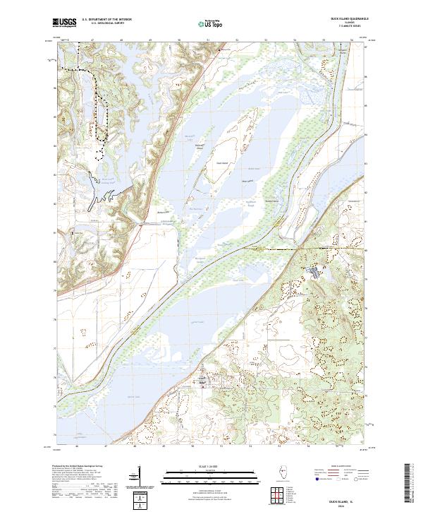
2024 Map of Duck Island
USGS Topo · Published 2024About this map
The Illinois River carves through a complex network of backwater lakes and sloughs in this 2024 survey of the central Illinois river valley. The landscape is dominated by the Chautauqua National Wildlife Refuge, where Lake Chautauqua and Quiver Lake provide critical habitat alongside sediment-rich features like Duck Island and Miserable Island. This area reflects a highly managed hydrological environment, evidenced by the Duck Creek Cooling Pond and various sloughs such as Buckbrush Slough and Goose Slough.
Find a feature on this map
60 named features on this map. Tap any name to fly to it.
Don’t see what you’re looking for? This feature index may not catch every label — zoom into the map to look around manually.
Map Details
Editions of this 2024 Duck Island Map
This is the sole edition of this map. No revisions or reprints were ever made.
Other maps of this area

1912 · Canton
USGS Topo · 1:62,500

1925 · Havana
USGS Topo · 1:62,500

1929 · Manito
USGS Topo · 1:62,500

1930 · Glasford
USGS Topo · 1:62,500

1932 · Manito
USGS Topo · 1:62,500

1947 · St. David
USGS Topo · 1:24,000

1947 · Havana
USGS Topo · 1:24,000

1948 · St. David
USGS Topo · 1:24,000
1948 · Havana
USGS Topo · 1:24,000

1948 · Glasford
USGS Topo · 1:62,500