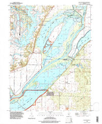
1996 Map of Duck Island
USGS Topo · Published 1997About this map
The Illinois River serves as the dominant artery for this central Illinois corridor, winding between the borders of Fulton, Mason, and Tazewell counties. A complex system of protective infrastructure is evident, with an extensive levee network shielding the riverbank and surrounding wetlands. This landscape is a mosaic of protected conservation areas, including the Rice Lake State Fish and Wildlife Area and the Chautauqua National Wildlife Refuge, indicating the region's importance for migratory birds and aquatic ecosystems.
Find a feature on this map
44 named features on this map. Tap any name to fly to it.
Don’t see what you’re looking for? This feature index may not catch every label — zoom into the map to look around manually.
Map Details
Editions of this 1996 Duck Island Map
This is the sole edition of this map. No revisions or reprints were ever made.
Other maps of this area

1912 · Canton
USGS Topo · 1:62,500

1925 · Havana
USGS Topo · 1:62,500

1929 · Manito
USGS Topo · 1:62,500

1930 · Glasford
USGS Topo · 1:62,500

1932 · Manito
USGS Topo · 1:62,500

1947 · St. David
USGS Topo · 1:24,000

1947 · Havana
USGS Topo · 1:24,000

1948 · St. David
USGS Topo · 1:24,000
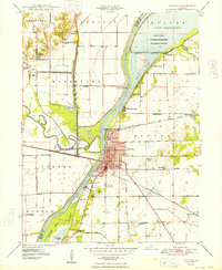
1948 · Havana
USGS Topo · 1:24,000

1948 · Glasford
USGS Topo · 1:62,500