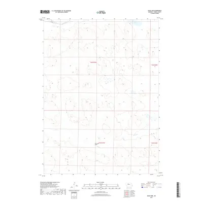
2017 Map of Duck Lake
USGS Topo · Published 2017About this map
Calf Creek Valley dominates the southern reaches of this landscape, where Calf Cr meanders through the Nebraska Sandhills. This 2017 survey by the U.S. Geological Survey documents a largely open and natural terrain within Cherry County, characterized by complex topographic depressions and ridges typical of this region. In the northeastern corner, Duck Lake stands as the primary water body, while Pass Cr and the winding Seneca Rd define the northern boundary. The map serves as a record of the public land survey system divisions across townships t26n r29w and t25n r29w, showing the enduring rural character of this cattle-ranching country.
Find a feature on this map
9 named features on this map. Tap any name to fly to it.
Don’t see what you’re looking for? This feature index may not catch every label — zoom into the map to look around manually.
Map Details
Editions of this 2017 Duck Lake Map
This is the sole edition of this map. No revisions or reprints were ever made.
Other maps of this area

1948 · Seneca
USGS Topo · 1:62,500

1948 · Seneca 4
USGS Topo · 1:62,500

1949 · Seneca 4
USGS Topo · 1:62,500

1951 · Seneca
USGS Topo · 1:62,500

1951 · Bull Lake
USGS Topo · 1:62,500

1951 · Brownlee
USGS Topo · 1:62,500

1957 · Valentine
USGS Topo · 1:250,000

1959 · Valentine
USGS Topo · 1:250,000

1985 · Goose Creek
USGS Topo · 1:100,000
1985 · Brownlee
USGS Topo · 1:24,000