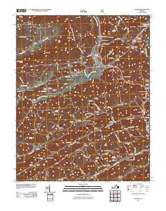
2011 Map of Duffield
USGS Topo · Published 2011About this map
The North Fork Clinch River and the Clinch River carve through a landscape of ridges and gaps, most notably featuring the remarkable Natural Tunnel. This area of Scott County is defined by its deep genealogical roots, visible through a dense concentration of family burial grounds such as the Bowen-Peterson Cemetery, Fraley Cemetery, and Minton Cemetery. The regional transportation network relies on historic passages like Kane Gap and Drakes Gap, connecting small settlements including Duffield and Pattonsville.
Find a feature on this map
101 named features on this map. Tap any name to fly to it.
Don’t see what you’re looking for? This feature index may not catch every label — zoom into the map to look around manually.
Map Details
Editions of this 2011 Duffield Map
This is the sole edition of this map. No revisions or reprints were ever made.
Other maps of this area

1894 · Estillville
USGS Topo · 1:125,000

1920 · Wise
USGS Topo · 1:48,000

1921 · Big Stone Gap
USGS Topo · 1:48,000

1921 · Wise
USGS Topo · 1:62,500

1922 · Big Stone Gap
USGS Topo · 1:62,500

1929 · Big Stone Gap
USGS Topo · 1:62,500

1935 · Moggasin
USGS Topo · 1:48,000

1935 · Looneys Gap
USGS Topo · 1:24,000

1935 · East Stone Gap
USGS Topo · 1:24,000
1935 · Keokee
USGS Topo · 1:24,000