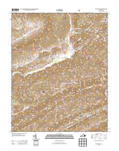
2013 Map of Duffield
USGS Topo · Published 2013About this map
Duffield serves as a central hub in this Scott County landscape, where the N Fork Clinch River and the Clinch River carve through a complex series of ridges and valleys. The presence of the Natural Tunnel and the nearby Bald Knob Tunnel highlights the region's historical reliance on rail infrastructure to navigate the difficult terrain of the River Knobs and Purchase Ridge. Small settlements like Pattonsville and Sloantown are connected by a network of state roads that follow the natural contours of the land, while family-named landmarks such as Powers Ford and Hunter Valley provide valuable clues for genealogists and local historians.
Find a feature on this map
105 named features on this map. Tap any name to fly to it.
Don’t see what you’re looking for? This feature index may not catch every label — zoom into the map to look around manually.
Map Details
Editions of this 2013 Duffield Map
This is the sole edition of this map. No revisions or reprints were ever made.
Other maps of this area

1894 · Estillville
USGS Topo · 1:125,000

1920 · Wise
USGS Topo · 1:48,000

1921 · Big Stone Gap
USGS Topo · 1:48,000

1921 · Wise
USGS Topo · 1:62,500

1922 · Big Stone Gap
USGS Topo · 1:62,500

1929 · Big Stone Gap
USGS Topo · 1:62,500

1935 · Moggasin
USGS Topo · 1:48,000

1935 · Looneys Gap
USGS Topo · 1:24,000

1935 · East Stone Gap
USGS Topo · 1:24,000
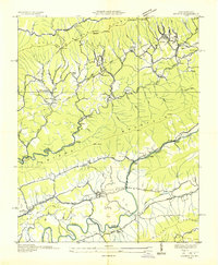
1935 · Keokee
USGS Topo · 1:24,000