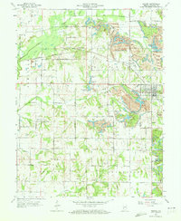
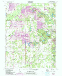
1963 Map of Dugger
USGS Topo · Published 1965About this map
The extractive landscape of Sullivan County's coal country is clearly visible in this mid-century survey, where active and retired Strip Mine operations dominate the topography around Dugger. The terrain is a complex network of industrial features, including a Tailings Pond, numerous Mine Dumps, and specialized water bodies like Reservoir North and the New Harmony Mine Pond. These workings are supported by a heavy rail presence, with both the Illinois Central Railroad and the Pennsylvania Railroad cutting across the territory to serve the collieries.
Find a feature on this map
54 named features on this map. Tap any name to fly to it.
Don’t see what you’re looking for? This feature index may not catch every label — zoom into the map to look around manually.
Map Details
Editions of this 1963 Dugger Map
5 editions found
Other maps of this area

1940 · Linton
USGS Topo · 1:24,000

1940 · Jasonville
USGS Topo · 1:24,000

1942 · Shelburn
USGS Topo · 1:24,000

1943 · Hymera
USGS Topo · 1:24,000

1943 · Carlisle
USGS Topo · 1:24,000

1943 · Sandborn
USGS Topo · 1:24,000

1943 · Sullivan
USGS Topo · 1:24,000

1943 · Dugger
USGS Topo · 1:24,000

1944 · Bucktown
USGS Topo · 1:24,000

1947 · Linton
USGS Topo · 1:24,000