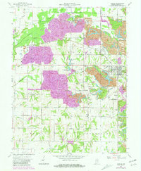
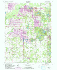
1963 Map of Dugger
USGS Topo · Published 1973About this map
Dugger serves as the primary hub in this landscape defined by heavy industrial coal extraction and the subsequent reclamation of the terrain into wooded recreation areas. The map reveals the extensive footprint of Strip Mine operations and numerous Mine Dump sites that have fundamentally altered the local topography between the settlements of Cass and Gambill. Overlapping these industrial zones, the Greene-Sullivan State Forest and its associated water bodies like Narrow Lake and T Lake suggest a transition toward conservation and reforestation.
Find a feature on this map
45 named features on this map. Tap any name to fly to it.
Don’t see what you’re looking for? This feature index may not catch every label — zoom into the map to look around manually.
Map Details
Editions of this 1963 Dugger Map
5 editions found
Other maps of this area

1940 · Linton
USGS Topo · 1:24,000

1940 · Jasonville
USGS Topo · 1:24,000

1942 · Shelburn
USGS Topo · 1:24,000

1943 · Hymera
USGS Topo · 1:24,000

1943 · Carlisle
USGS Topo · 1:24,000

1943 · Sandborn
USGS Topo · 1:24,000

1943 · Sullivan
USGS Topo · 1:24,000

1943 · Dugger
USGS Topo · 1:24,000

1944 · Bucktown
USGS Topo · 1:24,000

1947 · Linton
USGS Topo · 1:24,000