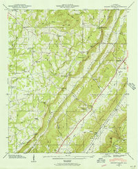
1946 Map of Dugout Valley
USGS Topo · Published 1956About this map
Dugout Valley and Big Dugout Valley define this landscape within De Kalb County, carved between the parallel heights of Sand Mountain and Lookout Mountain. The settlement of Hammondville sits at a geographic crossroads near the eastern edge, while rural life in the mid-1940s is reflected in a dense network of country churches and schools, such as Pine Grove Ch, Kings Chapel, and High Point Sch.
Find a feature on this map
62 named features on this map. Tap any name to fly to it.
Don’t see what you’re looking for? This feature index may not catch every label — zoom into the map to look around manually.
Map Details
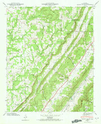
Editions of this 1946 Dugout Valley Map
2 editions found
Other maps of this area

1886 · Stevenson
USGS Topo · 1:125,000

1892 · Stevenson
USGS Topo · 1:125,000

1893 · Fort Payne
USGS Topo · 1:125,000

1895 · Stevenson
USGS Topo · 1:125,000

1898 · Fort Payne
USGS Topo · 1:125,000

1900 · Fort Payne
USGS Topo · 1:125,000

1936 · Ider
USGS Topo · 1:24,000

1936 · Dugout Valley
USGS Topo · 1:24,000

1936 · Chavies
USGS Topo · 1:24,000

1936 · Sulphur Springs
USGS Topo · 1:24,000