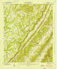
1947 Map of Dugout Valley
USGS Topo · Published 1947About this map
Dugout Valley and the surrounding heights of Sand Mountain define this northeast Alabama landscape just after the war. The terrain is marked by a series of parallel ridges and gaps, including Whiteoak Gap, Hammond Gap, and Snake Gap, which historically dictated the movement of residents and commerce through DeKalb County. The agricultural and social life of the era is anchored by numerous rural institutions, such as Pea Ridge Sch, Mt Olive Ch, and High Point Sch.
Find a feature on this map
72 named features on this map. Tap any name to fly to it.
Don’t see what you’re looking for? This feature index may not catch every label — zoom into the map to look around manually.
Map Details
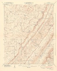
Editions of this 1947 Dugout Valley Map
2 editions found
Other maps of this area

1886 · Stevenson
USGS Topo · 1:125,000

1892 · Stevenson
USGS Topo · 1:125,000

1893 · Fort Payne
USGS Topo · 1:125,000

1895 · Stevenson
USGS Topo · 1:125,000

1898 · Fort Payne
USGS Topo · 1:125,000

1900 · Fort Payne
USGS Topo · 1:125,000

1936 · Ider
USGS Topo · 1:24,000

1936 · Dugout Valley
USGS Topo · 1:24,000

1936 · Chavies
USGS Topo · 1:24,000

1936 · Sulphur Springs
USGS Topo · 1:24,000