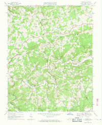
1968 Map of Dugspur
USGS Topo · Published 1971About this map
Dugspur serves as the focal point for this rural Virginia landscape, where the highlands of Indian Ridge and Brannon Ridge meet the headwaters of numerous mountain streams. The community's social structure is clearly defined by a high density of country churches, such as Bethesda Ch, Mitchell Chapel, and Mt Hebron Ch, alongside the Dugspur Sch. The drainage pattern is complex, with Big Reed Island Creek and Burks Fork carving through the terrain, while the State Prison Camp No 5 stands as a notable institutional presence near the Floyd County line.
Find a feature on this map
33 named features on this map. Tap any name to fly to it.
Don’t see what you’re looking for? This feature index may not catch every label — zoom into the map to look around manually.
Map Details
Editions of this 1968 Dugspur Map
2 editions found
Other maps of this area

1889 · Hillsville
USGS Topo · 1:125,000

1892 · Hillsville
USGS Topo · 1:125,000

1896 · Hillsville
USGS Topo · 1:125,000

1928 · Stuart
USGS Topo · 1:48,000

1931 · Stuart
USGS Topo · 1:62,500

1953 · Winston-Salem
USGS Topo · 1:250,000

1955 · Winston-Salem
USGS Topo · 1:250,000

1956 · Macks Mountain
USGS Topo · 1:62,500

1957 · Mount Airy
USGS Topo · 1:62,500

1957 · Floyd
USGS Topo · 1:62,500