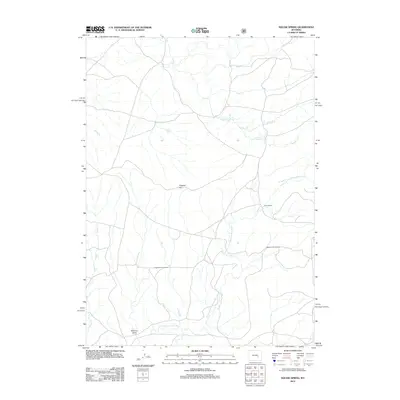
2012 Map of Dugway Rim
USGS Topo · Published 2012About this map
Squaw Spring sits near the heart of this high-plains landscape, where the drainage network of the N Fork Little Medicine Bow River and the Little Medicine Bow River dictates the layout of local travel and settlement. This 2012 survey by the U.S. Geological Survey details a region defined by ranching and homesteading history, notably marking the Taylor Ranch along with the Higginson Homestead and Eggleston Homestead.
Find a feature on this map
14 named features on this map. Tap any name to fly to it.
Don’t see what you’re looking for? This feature index may not catch every label — zoom into the map to look around manually.
Map Details
Editions of this 2012 Dugway Rim Map
This is the sole edition of this map. No revisions or reprints were ever made.
Other maps of this area

1954 · Torrington
USGS Topo · 1:250,000

1955 · Casper
USGS Topo · 1:250,000

1958 · Casper
USGS Topo · 1:250,000

1958 · Torrington
USGS Topo · 1:250,000

1959 · Moss Agate Reservoir
USGS Topo · 1:24,000

1959 · Squaw Spring
USGS Topo · 1:24,000

1959 · Chalk Hills
USGS Topo · 1:24,000

1959 · Bates Creek Reservoir
USGS Topo · 1:24,000

1960 · Ice Cave Mountain
USGS Topo · 1:24,000

1960 · Reno Hill
USGS Topo · 1:24,000