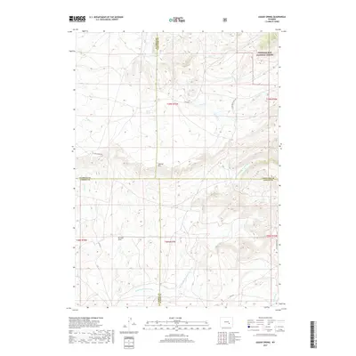
2017 Map of Dugway Rim
USGS Topo · Published 2017About this map
The Medicine Bow National Forest occupies the northeast corner of this high-altitude landscape, where the headwaters of numerous creeks begin their descent through the central Wyoming backcountry. This area is a complex meeting point of jurisdictional boundaries, where Natrona, Converse, Carbon, and Albany counties converge amidst a network of drainage systems. The prominent Dugway Rim forms a striking geographic divide in the center of the quadrangle, overlooking the southern basins fed by the N Fork Little Medicine Bow River.
Find a feature on this map
27 named features on this map. Tap any name to fly to it.
Don’t see what you’re looking for? This feature index may not catch every label — zoom into the map to look around manually.
Map Details
Editions of this 2017 Dugway Rim Map
This is the sole edition of this map. No revisions or reprints were ever made.
Other maps of this area

1954 · Torrington
USGS Topo · 1:250,000

1955 · Casper
USGS Topo · 1:250,000

1958 · Casper
USGS Topo · 1:250,000

1958 · Torrington
USGS Topo · 1:250,000

1959 · Moss Agate Reservoir
USGS Topo · 1:24,000

1959 · Squaw Spring
USGS Topo · 1:24,000

1959 · Chalk Hills
USGS Topo · 1:24,000

1959 · Bates Creek Reservoir
USGS Topo · 1:24,000

1960 · Ice Cave Mountain
USGS Topo · 1:24,000

1960 · Reno Hill
USGS Topo · 1:24,000