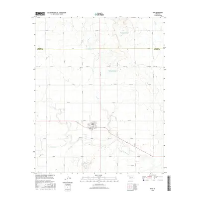
2016 Map of Duke
USGS Topo · Published 2016About this map
East Duke and the neighboring community of Duke anchor this southwest Oklahoma landscape along the Greer and Jackson County line. The settlement pattern follows a grid of section-line roads, including e1620 RD, which intersects the town's small street network of Chickasaw Ave, Seminole Ave, and Main ST. Outside the town center, the terrain is defined by the winding course of Turkey Cr and its tributaries, such as Spring Br and Horse Br. The map reveals a high concentration of burial sites for a rural area, including Rock Cem to the north, Duke Cem near the town, and the more isolated Guffin Cem and Cottonwood Cem. Water management is prominent through several reservoirs, such as Tri-County Turkey Cr Site 29a, indicating the importance of irrigation and flood control in this agricultural prairie region during the mid-2010s.
Find a feature on this map
50 named features on this map. Tap any name to fly to it.
Don’t see what you’re looking for? This feature index may not catch every label — zoom into the map to look around manually.
Map Details
Editions of this 2016 Duke Map
This is the sole edition of this map. No revisions or reprints were ever made.
Other maps of this area

1955 · Lawton
USGS Topo · 1:250,000

1964 · Martha
USGS Topo · 1:24,000

1964 · Olustee
USGS Topo · 1:24,000

1971 · Russell
USGS Topo · 1:24,000

1971 · Mangum South
USGS Topo · 1:24,000

1971 · Mc Queen
USGS Topo · 1:24,000

1971 · Duke SW
USGS Topo · 1:24,000

1971 · Duke
USGS Topo · 1:24,000

1971 · Prairie Hill
USGS Topo · 1:24,000

1971 · Hester
USGS Topo · 1:24,000