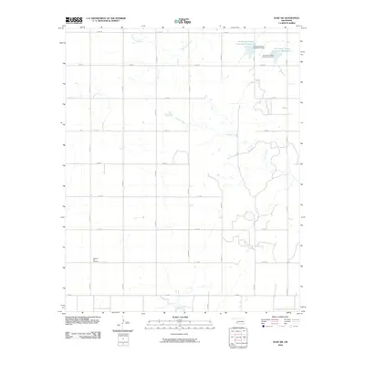
2010 Map of Duke SW
USGS Topo · Published 2010About this map
Pleasant Hill Cemetery sits at the intersection of n1810 RD and e1720 RD, serving as a focal point for genealogical interest in this rural Jackson County landscape. The terrain is defined by a systematic grid of section roads and a series of managed water resources in the northeastern corner. Significant water management features include the Tri-County Turkey Creek Site 23 Reservoir and Tri-County Turkey Creek Site 24 Reservoir, both held by namesake dams. These reservoirs, along with Cottonwood Creek and the meandering Gypsum Creek, illustrate the region's reliance on engineered catchment systems to support agriculture. To the south, Sandy Creek crosses the landscape, further highlighting the importance of seasonal drainage patterns in this corner of Oklahoma.
Find a feature on this map
24 named features on this map. Tap any name to fly to it.
Don’t see what you’re looking for? This feature index may not catch every label — zoom into the map to look around manually.
Map Details
Editions of this 2010 Duke SW Map
This is the sole edition of this map. No revisions or reprints were ever made.
Other maps of this area

1955 · Lawton
USGS Topo · 1:250,000

1960 · Goodlett
USGS Topo · 1:62,500

1960 · Quanah
USGS Topo · 1:62,500

1961 · Hollis
USGS Topo · 1:62,500

1971 · Mc Queen
USGS Topo · 1:24,000

1971 · Duke SW
USGS Topo · 1:24,000

1971 · Duke
USGS Topo · 1:24,000

1971 · Prairie Hill
USGS Topo · 1:24,000

1975 · Hollis NE
USGS Topo · 1:24,000

1975 · Hollis SE
USGS Topo · 1:24,000