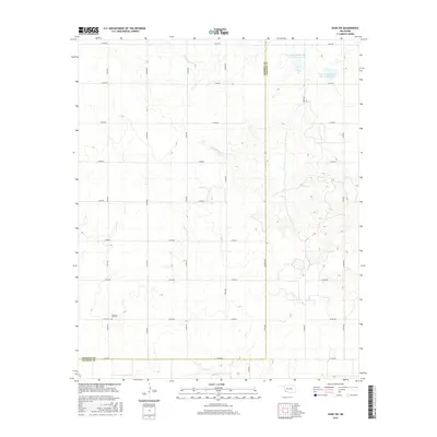
2016 Map of Duke SW
USGS Topo · Published 2016About this map
Pleasant Hill Cem stands as a primary genealogical landmark in this section of Southwest Oklahoma, situated near the western edge of the grid. The landscape is defined by the drainage systems of Gypsum Cr and Cottonwood Cr, which carve through the terrain as they flow toward the southern boundary. Significant water management features, specifically the Tri-County Turkey Cr Site 23 Reservoir and Tri-County Turkey Cr Site 24 Reservoir, dominate the northeastern corner of the map. The area's administrative history is visible along the western boundary where the line between Harmon Co and Jackson Co is clearly delineated. The road network follows a strict sectional grid, with numerous routes such as E1700 Rd and N1840 Rd providing access to the rural homesteads and agricultural tracts that characterize this high plains region.
Find a feature on this map
24 named features on this map. Tap any name to fly to it.
Don’t see what you’re looking for? This feature index may not catch every label — zoom into the map to look around manually.
Map Details
Editions of this 2016 Duke SW Map
This is the sole edition of this map. No revisions or reprints were ever made.
Other maps of this area

1955 · Lawton
USGS Topo · 1:250,000

1960 · Goodlett
USGS Topo · 1:62,500

1960 · Quanah
USGS Topo · 1:62,500

1961 · Hollis
USGS Topo · 1:62,500

1971 · Mc Queen
USGS Topo · 1:24,000

1971 · Duke SW
USGS Topo · 1:24,000

1971 · Duke
USGS Topo · 1:24,000

1971 · Prairie Hill
USGS Topo · 1:24,000

1975 · Hollis NE
USGS Topo · 1:24,000

1975 · Hollis SE
USGS Topo · 1:24,000