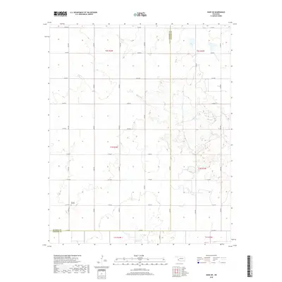
2018 Map of Duke SW
USGS Topo · Published 2018About this map
Pleasant Hill Cem stands as a focal point for family history in this corner of southwest Oklahoma, situated near the boundary where Harmon Co meets Jackson Co. The landscape is defined by the drainage patterns of Cottonwood Cr, Gypsum Cr, and Sandy Cr, which cut through the section lines of the Public Land Survey System. The map reveals a strictly organized rural grid of roads, such as E1650 Rd and N1810 Rd, which facilitate movement across the agricultural and ranching tracts of t1n r24w and t1n r23w. This 2018 survey provides a precise account of the modern terrain, showing how watercourses and cemetery locations remain consistent landmarks in a region largely defined by its township and range divisions.
Find a feature on this map
25 named features on this map. Tap any name to fly to it.
Don’t see what you’re looking for? This feature index may not catch every label — zoom into the map to look around manually.
Map Details
Editions of this 2018 Duke SW Map
This is the sole edition of this map. No revisions or reprints were ever made.
Other maps of this area

1955 · Lawton
USGS Topo · 1:250,000

1960 · Goodlett
USGS Topo · 1:62,500

1960 · Quanah
USGS Topo · 1:62,500

1961 · Hollis
USGS Topo · 1:62,500

1971 · Mc Queen
USGS Topo · 1:24,000

1971 · Duke SW
USGS Topo · 1:24,000

1971 · Duke
USGS Topo · 1:24,000

1971 · Prairie Hill
USGS Topo · 1:24,000

1975 · Hollis NE
USGS Topo · 1:24,000

1975 · Hollis SE
USGS Topo · 1:24,000