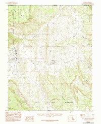
1983 Map of Dulce
USGS Topo · Published 1983About this map
The Jicarilla Apache Indian Reservation defines the western landscape of this northern New Mexico borderland, where the Navajo River flows through high mesas and deep canyons. Centered on the settlement of Dulce, the map provides a look at the regional infrastructure as it stood in the late 1970s, including the Dulce Airport and nearby Lumberton. Trace the legacy of early 20th-century transportation along the Old RR Grade, which runs parallel to Amargo Creek and connects the former community of Amargo to the surrounding hills. The topography is dominated by prominent landforms such as Archuleta Mesa on the Colorado state line and the rising peaks of Dulce Mountain to the south. Numerous drainage systems, including Webb Creek and Coyote Creek, carve out a network of canyons such as Webb Canyon and Miller Canyon, illustrating the complex drainage patterns of the Rio Arriba highlands.
Find a feature on this map
27 named features on this map. Tap any name to fly to it.
Don’t see what you’re looking for? This feature index may not catch every label — zoom into the map to look around manually.
Map Details
Editions of this 1983 Dulce Map
2 editions found
Other maps of this area

1889 · Largo
USGS Topo · 1:250,000

1895 · Largo
USGS Topo · 1:250,000

1913 · Summitville
USGS Topo · 1:125,000

1915 · Summitville
USGS Topo · 1:125,000

1924 · Pagosa Springs
USGS Topo · 1:125,000

1927 · Pagosa Springs
USGS Topo · 1:125,000

1945 · Durango
USGS Topo · 1:250,000

1953 · Durango
USGS Topo · 1:250,000

1954 · Durango
USGS Topo · 1:250,000

1954 · Aztec
USGS Topo · 1:250,000