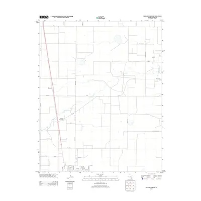
2012 Map of Dumas North
USGS Topo · Published 2012About this map
S Palo Duro Cr cuts a winding path across the Moore County panhandle, providing a natural break in the geometric grid of agricultural roads and section lines. The settlement of Braden occupies the southern edge of the map, where residential streets like Norma St and N Maddox Ave meet the open Texas plains. Further north, small locales such as Machovec and Sheerin are situated along key transport corridors, including FM-119 and the prominent north-south highway. The naming of local thoroughfares like Carbon Black Rd, Nitrate Rd, and Morton Elevator Rd reflects the industrial and agricultural underpinnings of the local economy during the early 21st century. Northlawn Memorial Cem stands as a significant landmark for those tracing local family roots in this expansive landscape.
Find a feature on this map
43 named features on this map. Tap any name to fly to it.
Don’t see what you’re looking for? This feature index may not catch every label — zoom into the map to look around manually.
Map Details
Editions of this 2012 Dumas North Map
This is the sole edition of this map. No revisions or reprints were ever made.
Other maps of this area

1954 · Tucumcari
USGS Topo · 1:250,000

1954 · Perryton
USGS Topo · 1:250,000

1954 · Amarillo
USGS Topo · 1:250,000

1954 · Dalhart
USGS Topo · 1:250,000

1958 · Perryton
USGS Topo · 1:250,000

1958 · Amarillo
USGS Topo · 1:250,000

1958 · Tucumcari
USGS Topo · 1:250,000

1958 · Dalhart
USGS Topo · 1:250,000

1962 · Dalhart
USGS Topo · 1:250,000

1963 · Cactus East
USGS Topo · 1:24,000