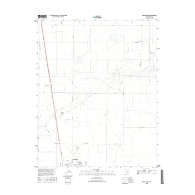
2016 Map of Dumas North
USGS Topo · Published 2016About this map
Dumas sits at the southern edge of this Moore County landscape, where the town's northern expansion meets the high plains of the Texas Panhandle. The terrain is defined by the winding course of S Palo Duro Cr, which cuts through the center of the sheet and influences the local road network. Agricultural and industrial infrastructure is evident through features like Morton Elevator Rd and the outlying settlements of Machovec and Sheerin. Residential streets such as N Maddox Ave, Oak Ave, and Elm Ave show the organized growth of the community northward. The map also captures local landmarks and curiosities, from the Northlawn Memorial Gardens cemetery to the uniquely named Beer Can Aly, providing a detailed look at the rural and municipal layout of this High Plains region.
Find a feature on this map
44 named features on this map. Tap any name to fly to it.
Don’t see what you’re looking for? This feature index may not catch every label — zoom into the map to look around manually.
Map Details
Editions of this 2016 Dumas North Map
This is the sole edition of this map. No revisions or reprints were ever made.
Other maps of this area

1954 · Tucumcari
USGS Topo · 1:250,000

1954 · Perryton
USGS Topo · 1:250,000

1954 · Amarillo
USGS Topo · 1:250,000

1954 · Dalhart
USGS Topo · 1:250,000

1958 · Perryton
USGS Topo · 1:250,000

1958 · Amarillo
USGS Topo · 1:250,000

1958 · Tucumcari
USGS Topo · 1:250,000

1958 · Dalhart
USGS Topo · 1:250,000

1962 · Dalhart
USGS Topo · 1:250,000

1963 · Cactus East
USGS Topo · 1:24,000