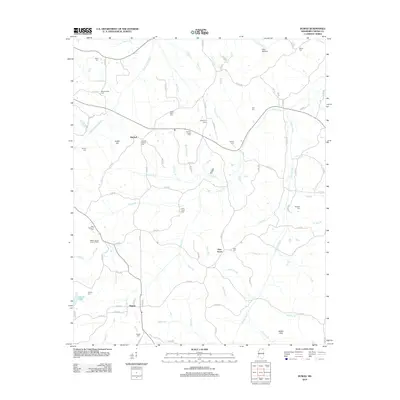
2012 Map of Dumas
USGS Topo · Published 2012About this map
Dumas and Pine Grove anchor this portion of Tippah County, where the headwaters of the Hatchie River and Little Hatchie River carve a dense network of creek valleys. The landscape is defined by its rural community centers and numerous family and church burial grounds, such as Paynes Chapel Cem, Westminister Cem, and Turners Chapel Cem. A prominent topographical feature, Kelley Hill, rises above the bottomlands where Mitchell Br and Neely Br converge. The presence of the Tippah County Lookout Tower near Smith Br suggests the importance of forest management in this timber-heavy region. Tracing the county road network reveals the historic connectivity between small settlements like Mitchell and the low-lying Gus Bottom to the north.
Find a feature on this map
102 named features on this map. Tap any name to fly to it.
Don’t see what you’re looking for? This feature index may not catch every label — zoom into the map to look around manually.
Map Details
Editions of this 2012 Dumas Map
This is the sole edition of this map. No revisions or reprints were ever made.
Other maps of this area

1921 · Booneville
USGS Topo · 1:48,000

1922 · Booneville
USGS Topo · 1:62,500

1950 · Corinth
USGS Topo · 1:62,500

1951 · Walnut
USGS Topo · 1:62,500

1955 · Ripley
USGS Topo · 1:62,500

1956 · Tupelo
USGS Topo · 1:250,000

1958 · Tupelo
USGS Topo · 1:250,000

1972 · Jumpertown
USGS Topo · 1:24,000
1973 · Baldwyn
USGS Topo · 1:24,000
1982 · Kossuth South
USGS Topo · 1:24,000