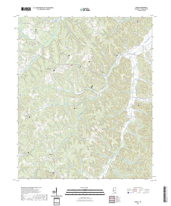
2024 Map of Dumas
USGS Topo · Published 2024About this map
Dumas serves as a primary settlement in this rural Tippah County landscape, where the headwaters of the Little Hatchie River and Hatchie River carve through the terrain. The map reveals a high density of country burial grounds and small community hubs, such as Mitchell and Pine Grove, which are connected by a network of local roads including Dale Earnhart Rd and various county routes. Family history is deeply rooted here, evidenced by landmarks like Kelley Hill and Sadler Hills, alongside numerous family-named cemeteries such as Jeter Cem, Walker Cem, and Chapman Cem. The drainage patterns, defined by branches like Shackelford Branch and Wingo Branch, show how the local topography influenced the placement of farms and small settlements. This survey provides a modern accounting of these enduring rural landmarks, from the Boxs Chapel Cem in the east to the Westminister Cem in the northwest.
Find a feature on this map
103 named features on this map. Tap any name to fly to it.
Don’t see what you’re looking for? This feature index may not catch every label — zoom into the map to look around manually.
Map Details
Editions of this 2024 Dumas Map
This is the sole edition of this map. No revisions or reprints were ever made.
Other maps of this area

1921 · Booneville
USGS Topo · 1:48,000

1922 · Booneville
USGS Topo · 1:62,500

1950 · Corinth
USGS Topo · 1:62,500

1951 · Walnut
USGS Topo · 1:62,500

1955 · Ripley
USGS Topo · 1:62,500

1956 · Tupelo
USGS Topo · 1:250,000

1958 · Tupelo
USGS Topo · 1:250,000

1972 · Jumpertown
USGS Topo · 1:24,000
1973 · Baldwyn
USGS Topo · 1:24,000
1982 · Kossuth South
USGS Topo · 1:24,000