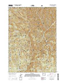
2014 Map of Dumont Creek
USGS Topo · Published 2014About this map
The South Umpqua River winds through the heart of this drainage basin within the Umpqua National Forest, defining the region's steep topography and watershed network. The landscape is marked by prominent high points such as Smith Ridge, Boulder Rock, and Hbb Knob, which overlook a complex system of tributaries including Dumont Creek and Boulder Cr. Forest management and resource access are evidenced by a dense network of development roads and spurs like Nat For Dev Rd 2813 and the Smith Ridge Rd. A notable point of human activity in this wilderness is the Zinc Cr Bridge Camp, situated where Zinc Creek meets the river. The presence of Campbell Falls further underscores the river's significant drop in elevation as it cuts through the mountains, while locations like Clayton Point provide strategic vantage points over the narrow valleys.
Find a feature on this map
60 named features on this map. Tap any name to fly to it.
Don’t see what you’re looking for? This feature index may not catch every label — zoom into the map to look around manually.
Map Details
Editions of this 2014 Dumont Creek Map
This is the sole edition of this map. No revisions or reprints were ever made.
Other maps of this area

1891 · Ashland
USGS Topo · 1:250,000

1893 · Ashland
USGS Topo · 1:250,000

1897 · Ashland
USGS Topo · 1:250,000

1944 · Tiller
USGS Topo · 1:62,500

1944 · Abbott Butte
USGS Topo · 1:62,500

1947 · Abbott Butte
USGS Topo · 1:62,500

1955 · Quartz Mtn
USGS Topo · 1:62,500

1955 · Red Butte
USGS Topo · 1:62,500

1955 · Medford
USGS Topo · 1:250,000

1957 · Medford
USGS Topo · 1:250,000