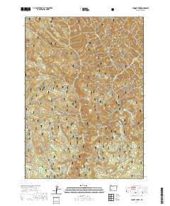
2020 Map of Dumont Creek
USGS Topo · Published 2020About this map
The South Umpqua River carves through the heart of this landscape, serving as a primary drainage for the surrounding Umpqua National Forest. The terrain is defined by significant elevations such as Smith Ridge in the northwest and Hob Knob to the southwest, with the drainage network featuring several prominent tributaries including Dumont Creek, Zinc Creek, and Budd Creek. A notable landmark is Campbell Falls, located where several creeks converge near the eastern boundary of the quadrangle. This 2020 survey records an extensive network of Forest Service roads, such as Nfst-2719800 and Nfst-2813109, which provide access to high points like Clayton Point and Boulder Rock. The map illustrates a managed wilderness where topography dictates the path of both water and access routes through the deep interior of Douglas County.
Find a feature on this map
37 named features on this map. Tap any name to fly to it.
Don’t see what you’re looking for? This feature index may not catch every label — zoom into the map to look around manually.
Map Details
Editions of this 2020 Dumont Creek Map
This is the sole edition of this map. No revisions or reprints were ever made.
Other maps of this area

1891 · Ashland
USGS Topo · 1:250,000

1893 · Ashland
USGS Topo · 1:250,000

1897 · Ashland
USGS Topo · 1:250,000

1944 · Tiller
USGS Topo · 1:62,500

1944 · Abbott Butte
USGS Topo · 1:62,500

1947 · Abbott Butte
USGS Topo · 1:62,500

1955 · Quartz Mtn
USGS Topo · 1:62,500

1955 · Red Butte
USGS Topo · 1:62,500

1955 · Medford
USGS Topo · 1:250,000

1957 · Medford
USGS Topo · 1:250,000