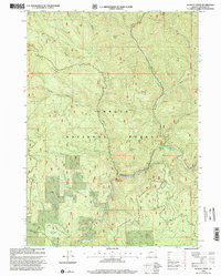
1998 Map of Dumont Creek
USGS Topo · Published 2000About this map
The South Fork Umpqua River carves through the timberlands of the Umpqua National Forest in this late-twentieth-century survey. The landscape is defined by its drainage network, where Dumont Creek and Slick Creek feed into the main river channel near established recreational sites like the Dumont Creek Campground and Boulder Creek Campground. High points such as Smith Ridge and Clayton Point overlook a terrain marked by extensive resource extraction, indicated by numerous quarries scattered across the forest slopes.
Find a feature on this map
26 named features on this map. Tap any name to fly to it.
Don’t see what you’re looking for? This feature index may not catch every label — zoom into the map to look around manually.
Map Details
Editions of this 1998 Dumont Creek Map
This is the sole edition of this map. No revisions or reprints were ever made.
Other maps of this area

1891 · Ashland
USGS Topo · 1:250,000

1893 · Ashland
USGS Topo · 1:250,000

1897 · Ashland
USGS Topo · 1:250,000

1944 · Tiller
USGS Topo · 1:62,500

1944 · Abbott Butte
USGS Topo · 1:62,500

1947 · Abbott Butte
USGS Topo · 1:62,500

1955 · Quartz Mtn
USGS Topo · 1:62,500

1955 · Red Butte
USGS Topo · 1:62,500

1955 · Medford
USGS Topo · 1:250,000

1957 · Medford
USGS Topo · 1:250,000